People walk next to a sand berm built by the city of Long Beach in preparation for high tide along the Peninsula on Feb. 19, 2024.
(
Damian Dovarganes
/
AP
)
Support your source for local news!
In these challenging times, the need for reliable local reporting has never been greater. Put a value on the impact of our year-round coverage. Help us continue to highlight LA stories, hold the powerful accountable, and amplify community voices. Your support keeps our reporting free for all to use. Stand with us today.
Southern California got a brief break from the wet weather Tuesday morning, but even more heavy rain is in store through Wednesday.
The latest winter storm isn't expected to bring the same deluge as the atmospheric river earlier this month, but the lengthy system still poses major risks to the area. And it's the rain that has already fallen that's a big concern, as areas west of Los Angeles grapple with saturated ground and mudslides.
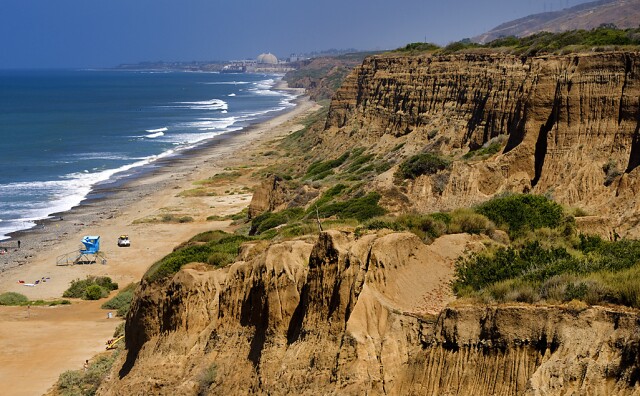
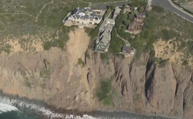
On Monday afternoon, L.A. County Supervisor Janice Hahn urged Gov. Gavin Newsom to visit Rancho Palos Verdes, where sights of buckling streets and houses are worthy of an emergency declaration, she said on social media. The famed Wayfarers Chapel announced last week it would close to the public because of similar land movement.
Wayfarers Chapel closed to the public last week after land movement following heavy rains in Rancho Palos Verdes. That movement is clearly visible in the roadway below as well as in cracks throughout the properties walkways and foundations.
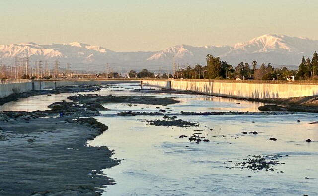
This latest storm, with moderate to heavy rain predicted on and off until Wednesday, lands on the heels of back-to-back atmospheric rivers that caused widespread damage to the Los Angeles region, including numerous landslides.
This is now the fifth wettest February for downtown L.A., and the 10th wettest of any month, since the National Weather Service started keeping records in 1877.
Impacts
As of 8 a.m. Tuesday, the city of L.A. reported:
87 fallen trees and branches, 15 of which have been resolved
39 flooding incidents, including blockages of catch basins and storm drains. 27 reports have been resolved.
31 debris and mudflows
460 LADWP customers with power outages. Power has been restored to 29,202 customers.
All L.A. County beaches are under an ocean water quality rain advisory until at least 5 a.m. Friday.
The Department of Public Health is warning people to avoid all contact with the water, especially around storm drains, creeks, and rivers — it could make you sick. The water may be contaminated with bacteria, chemicals, trash, and other public health hazards that wash off the city streets in a storm.
The advisory will be in effect for 72 hours after the rain ends, so it could end up being extended. The Inner Cabrillo Beach in San Pedro is still closed after a sewage spill from the last storm.
Los Angeles County beaches are dealing with big waves and very high rip currents as another winter storm passes through.
(
Los Angeles County Lifeguards
/
Los Angeles County Lifeguards
)
All L.A. County beaches, Catalina Island, and the Malibu coast are also under a high surf advisory until 9 p.m. Tuesday.
Large waves between 6 and 10 feet are expected, with sets up to 12 feet, which can sweep people off beaches and capsize small boats near shore. Dangerous rip currents are also expected, which can pull swimmers and surfers out to sea.
People are encouraged to stay out of the water and stay away from rocks. If you still want to go in the ocean, be near an occupied lifeguard tower.
These are some of the three-day rainfall totals as of 5 p.m. Tuesday:
Topanga - 6.48 inches
Bel Air - 4.28 inches
Porter Ranch - 3.78 inches
Beverly Hills - 3.14 inches
Pasadena - 2.58 inches
Woodland Hills - 2.50 inches
Santa Monica - 2.34 inches
Downtown L.A. - 1.72 inches
The Orange County coastal areas haven’t seen as much rain, with the highest total at 1.88 inches for the O.C. reservoir as of 4 p.m. Tuesday. However, crews have continued to try to minimize the damage to a San Clemente coastal rail corridor that’s been routinely impacted by landslides and debris.
Parts of the track have been covered in a plastic tarp, but even with that protection, rain has continued to seep into the already saturated slope, according to the Orange County Transportation Authority (OCTA).
The slope movement jumped to about 10 to 12 inches today, up from 1 to 2 inches before the rain.
With even more wet weather expected, crews will continue to keep an eye on the tracks, but it’s still stable and freight trains are scheduled to pass through overnight at reduced speeds.
A high surf advisory is also in effect until 10 p.m. Tuesday.
Large waves between 5 and 9 feet are expected, with local sets of 10 and 12 feet. The surf is expected to peak throughout the day before seriously tapering off Tuesday night.
The ocean conditions could be dangerous, so inexperienced swimmers and surfers are warned to stay out of the water.
Forecast
Most of L.A. County is currently under a flood watch through 10 a.m. Wednesday, with spots of severe weather, including thunderstorms, expected through Tuesday night.
1.5 to 3 inches of rain in L.A. County, with up to 5 inches in the foothills and mountains, including the Santa Monicas
1 to 2 inches of rain in Ventura County, with up to 4 inches in the foothills and mountains
10 to 20 more inches of snow is possible above 7,500 feet, but that will lower to 6,000 feet Tuesday night
High surf and coastal flooding possible
About 20% chance of thunderstorms in most areas
Wind gusts between 30 and 50 mph, mainly in L.A. and Ventura counties
(
Courtesy National Weather Service
)
Evacuations and closures
Los Angeles County
An evacuation warning for Zone 4 will be in in effect in the Topanga Canyon area through 9 a.m. Wednesday due to possible mud or debris flows. The area under the warning is along Santa Maria Road north of Topanga Canyon Road.
The area of Topanga Canyon shaded here, known as Zone 4, is under an evacuation warning from authorities.
(
Courtesy LASD
)
Caltrans reports for L.A. and Ventura counties include:
A big sinkhole has shut down the off-ramp at the Skirball Center/Mulholland Drive exit until further notice.
Three lanes of the 101 Freeway are closed in the city of Ventura for the duration of the storm due to flooding. From Seaward Avenue to California Street the northbound left lane and two southbound lanes are closed.
PCH between Sycamore Canyon Road to Las Posas Road in Ventura County remains closed overnight in both directions from at least 6 p.m. to 7 a.m. or later. This is due to erosion.
State Route 150 is down to one lane of traffic 3 miles north of Santa Paula until further notice, causing delays.
At Emma Woods State Beach north of the city of Ventura, the 101 Freeway northbound offramp, and southbound onramp, are closed. The northbound side of the bike path is also impacted due to flooding and mud under the bridge.
Mulholland Drive is closed between Skyline Drive and Bowmont Drive.
There is a soft closure on Benedict Canyon between Mulholland Drive and Hutton Drive, and soft closures at Mulholland Drive and Coldwater Canyon Drive.
Sepulveda Basin, between Burbank Boulevard and Hayvenhurst Avenue and Victory Boulevard and Woodley Avenue, are closed due to flooding.
Santa Barbara County
Evacuation warnings have been issued for these areas:
Properties along waterways associated with the Alisal burn area.
Properties in the vicinity of Sycamore Creek, from Stanwood Drive down to parts of Ninos Drive, in the city of Santa Barbara.
Properties in the vicinity of Mission Creek, from Cota Street down to Highway 101 and between Chapala Street and Castillo Street, in the city of Santa Barbara.
Enhanced-color Air Mass imagery via @NOAA's #GOESWest 🛰️ is tracking a strong Pacific storm bringing another atmospheric river to California this morning. #WinterStorm Warnings and #Flood Watches are in effect for much of the state.
Residents in mountain, canyon, and coastal areas should prepare for debris flows and flooding over the next week.
Those in landslide prone areas like the Palos Verdes Peninsula should be on the lookout for indications of land movement, including the formation of new cracks, the fracturing of underground utilities, doors and windows falling out of plumb and sounds of creaks and groans coming from the ground.
Los Angeles County Fire Department locations also have sandbags and sand.
Sand and sandbags are available at these locations in Orange County.
Understanding National Weather Service warnings
Here’s an excerpt from our guide to understanding flood warnings, if any are issued:
Flood advisories are how the NWS begins to raise the alarm. The goal is to give people enough time to take action.
Flood watches are your indicators to get prepared to move.
Aflood warning is issued when a hazardous weather event is imminent or already happening. When one is issued for your area, you need to get to higher ground immediately.
A flash flood warning is issued when a flash flood is coming or in progress. Flash floods are sudden and violent floods that can start within minutes.
If you're in L.A. County and need sand bags you can find some at local fire houses.
Staying safe when the winds are high
Watch for traffic signals that may be out. Approach those intersections as four-way stops.
Make sure you have a battery-operated radio and flashlights. Check the batteries to make sure they are fresh. Use flashlights for lighting during a power outage; do not use candles because they may pose a significant fire hazard.
If you’re in a vehicle with a fallen power line on it, stay in the vehicle and remain calm until help arrives. It is OK to use your cellphone to call 911. If you must leave the vehicle, remember to exit away from downed power lines and exit by jumping from the vehicle and landing with both feet together. You must not touch the vehicle and the ground at the same time. Then proceed away from the vehicle by shuffling and not picking up your feet until you are several yards away.
Water and electricity don’t mix. Water is an excellent conductor of electricity. Do not step in or enter any water that a downed power line may be touching.
Do not use any equipment inside that is designed for outdoor heating or cooking. Such equipment can emit carbon monoxide and other toxic gases.
If you use a generator, place it outdoors and plug individual appliances directly into it, using a heavy-duty extension cord. Connecting generators directly to household circuits creates “backfeed,” which is dangerous to repair crews.
Leave the doors of your refrigerator and freezer closed to keep food as fresh as possible. Place blocks of ice inside to help keep food cold. Check food carefully for signs of spoilage.
Check on your neighbors to make sure everyone is safe.
Tips on staying warm
State law requires residential units to have heating systems that can keep indoor temperatures at a minimum of 70 degrees. That means every dwelling unit and guest room offered for rent or lease should offer heating equipment, usually central air conditioning (A/C) or a wall heater. — Caitlin Hernández
Use heat smartly to save money: Cranking things like the A/C and wall heaters can be expensive. If money is tight, be judicious about how and when you use your utilities. For example, only use heaters at night or only set the thermostat to around 70 degrees.
Open and close those vents: If you have central A/C, look at where the vents are around your home. Are any open in places where you don’t stay long? Practice opening and closing those so warm air only goes where you need it (most vents should have a small toggle lever). Humidifiers can also help you warm things up — and it’s useful to add moisture into our dry air.
Adjust your wall heaters: If you have a wall heater, you can change the output by adjusting the knob (usually at the bottom). Since wall heaters can only warm the areas where they’re placed, it’s essential to close doors to rooms you won’t be in so hot air doesn’t get wasted.
Turn on your ceiling fan (really): If you have a ceiling fan, try turning it on. This sounds counterintuitive, but there’s science behind it. The direction a fan turns can push air in different directions, and since hot air floats up, you’ll want to move that around. Your fan should spin clockwise to create an updraft to circulate. Not all fans will have this option, though.
In December, the L.A. County Board of Supervisors voted to adopt a long-term stormwater capture plan, that includes cleaning up groundwater, improving drinking water quality, expanding the use of recycled water, and using better messaging around water conservation.
This is a developing story. We fact check everything and rely only on information from credible sources (think fire, police, government officials and reporters on the ground). Sometimes, however, we make mistakes and/or initial reports turn out to be wrong. In all cases, we strive to bring you the most accurate information in real time and will update this story as new information becomes available.
Your questions or ideas
What questions do you have about the atmospheric river?
A major storm system is coming to Southern California. We're here to answer your questions.
Since 2021, volunteers have been planting Joshua tree seedlings in the Mojave Desert burn scar. The next session is slated for later this Spring, according to the National Park Service. Just like previous times, a few camels will be tagging along.
There are three main meteorological reasons why L.A. is so smoggy — all of which are affected when a rainstorm passes through and brings clearer skies.