In these challenging times, the need for reliable local reporting has never been greater. Put a value on the impact of our year-round coverage. Help us continue to highlight LA stories, hold the powerful accountable, and amplify community voices. Your support keeps our reporting free for all to use. Stand with us today.
It's always fun to see how dramatically California changes throughout the rainy season, which runs from November to April. And while much of the Golden State had a slow start, precipitation's really picked up over the past month or so, as you can see in these satellite images.
Any shortage of snowfall gives us a bit of anxiety because snow is one of our greatest stores of water and our dry months are quickly coming up.
Big Bear
First up is Big Bear in the San Bernardino Mountains at 6,759 feet. It was largely snow free in December, but from January through February, 25.2 inches of snow fell. The average annual snowfall for the mountain is typically around 54 inches, so they're still quite far behind.
Warmer storm systems have meant that more precipitation than usual has fallen as rain rather than snow.
Mt. Baldy
About 70 miles to the north there's Mt. Baldy, the highest peak in the San Gabriel Mountains at 10,064 feet.
At Mt. Baldy Resort, located at 6,300 feet, 36 inches have fallen.
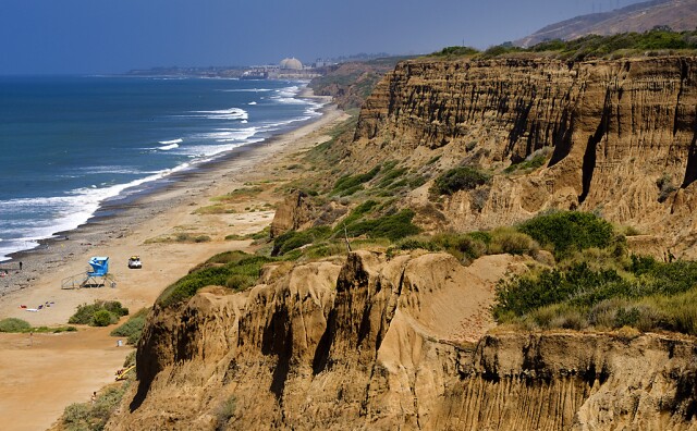
L.A. Mountains
The mountains around the L.A. Basin have changed as well, greening with the heavy rains.
Downtown L.A. typically gets 15 inches of rain a year, but so far it's seen 17.89 inches.
Topanga Canyon, along the bottom left side of the image, averages 23.68 inches. This year they've been drenched with 32.80 inches. Much of that came in late January and early February.
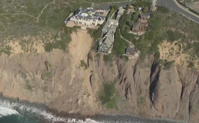
Because of the concentrated heavy rainfall, we've seen a number of landslides.
Homes along Scenic Drive last week following heavy rains in Dana Point after a landslide brought tons of rock and soil crashing into the sea.
(
Patrick T. Fallon
/
AFP via Getty Images
)
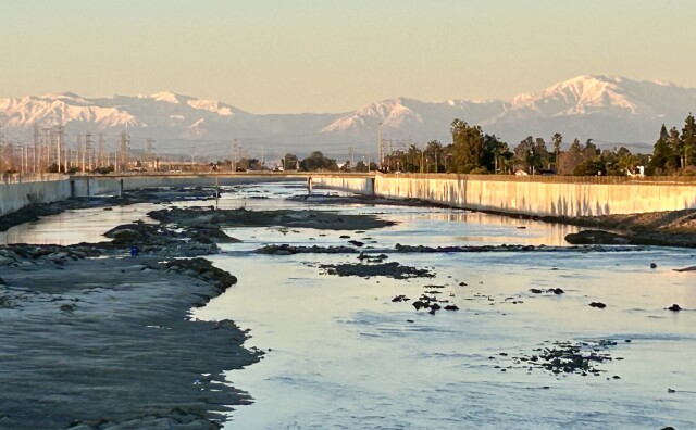
Check out stormwater runoff
Compare these two images of L.A.'s coast and you can see how much sediment the recent rains sent out into the ocean, and where the stormwater drains are.
It's great that Yosemite and Mono Lake are blanketed in snow, however, the central Sierra Nevada is still only at 67% of normal for April 1. That means there's a bit of catching up to do.
Lake Tahoe in the northern part of the Sierra Nevada is looking a bit better, sitting at 81% of normal for April 1.
The incoming storm
The good news is that a big storm this week will likely boost those numbers. More than 6 feet of snow could fall on some parts of the Sierra Nevada.
What do you want to know about fires, earthquakes, climate change or any science-related topics?
Jacob Margolis helps Southern Californians understand the science shaping our imperfect paradise and gets us prepared for what’s next.
Since 2021, volunteers have been planting Joshua tree seedlings in the Mojave Desert burn scar. The next session is slated for later this Spring, according to the National Park Service. Just like previous times, a few camels will be tagging along.
There are three main meteorological reasons why L.A. is so smoggy — all of which are affected when a rainstorm passes through and brings clearer skies.